
Value of Post Processing GPR Field Data
Using post processing software “GPR Insights”
to filter and enhance GPR field data.
Project Background and Findings
Slide 3
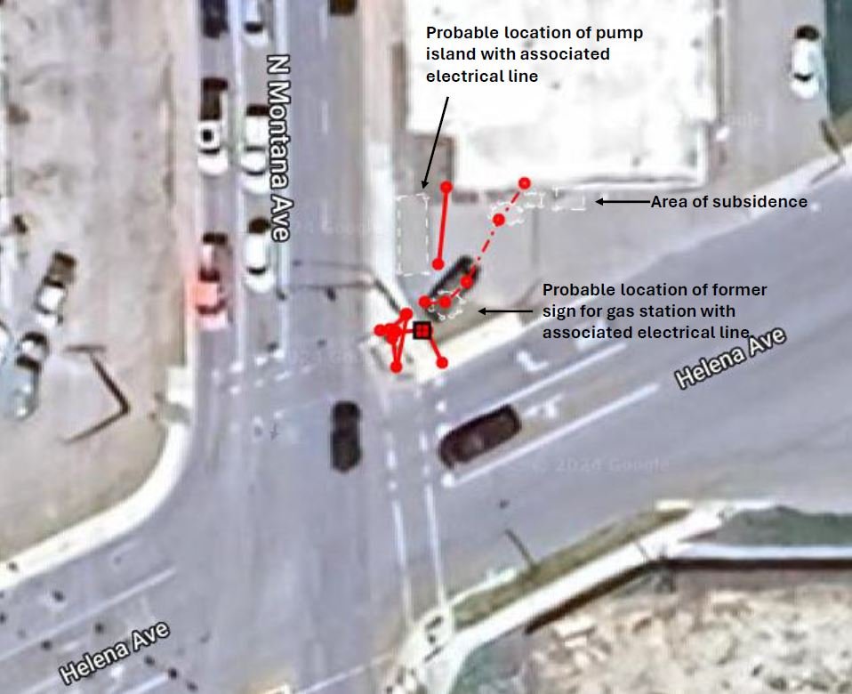
Last summer I was contacted by an engineering firm to find and map utilities as well as use ground penetrating radar to determine the location of any buried underground storage tanks (UST) or associated piping at a business that was originally a gas station. I used EM locating methods as well as GPR to determine the location of buried utilities as shown on the utility map I created using my GPS mapping software shown to the left.

Slide 4
GPR scanning results prior to post processing. The project area was scanned in two separate scans shown left and right.
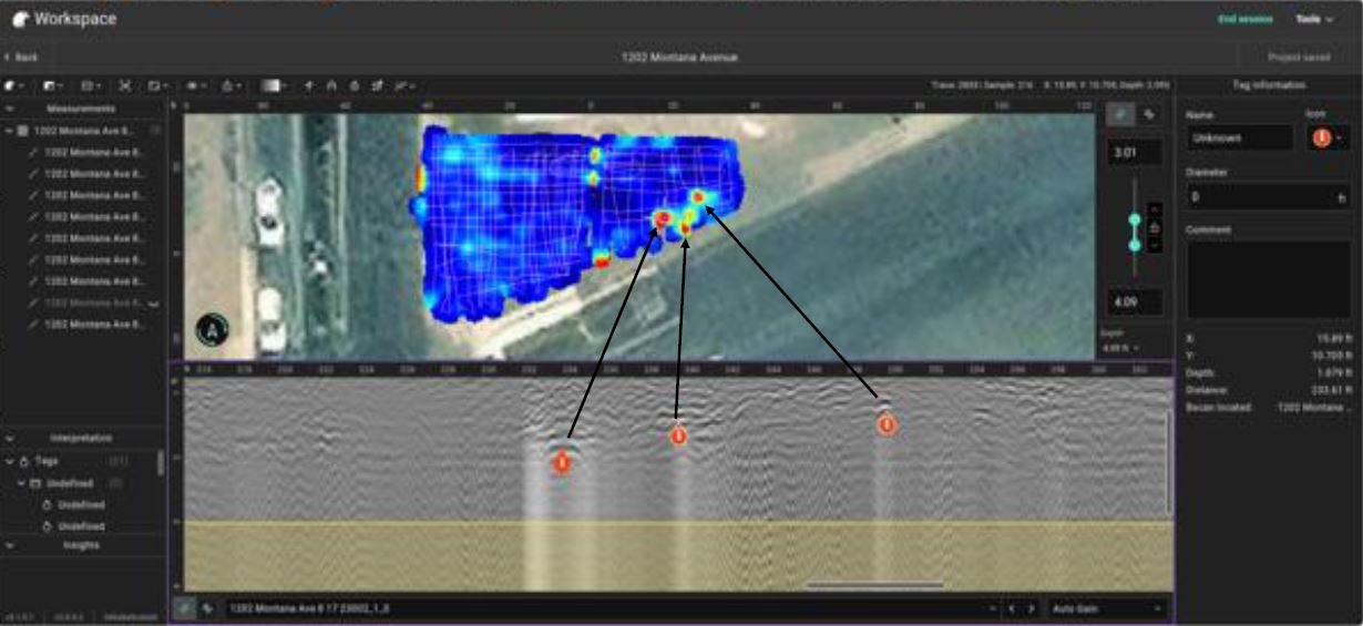
Slide 5 shows the GPR data after merging the scans and post processing by applying several filters.
Slide 5
GPR data after merging the scans and post processing by applying several filters.
Slide 6
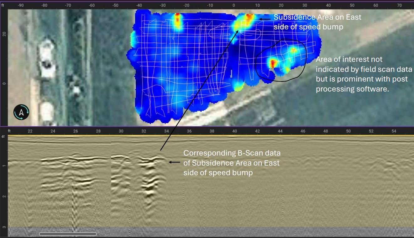
Enhanced GPR data from 3 to 4 feet below ground surface with corresponding B-Scan data on the bottom half of picture indicating GPR responses a possible UST and associated piping. This data was not indicated prior to post processing with GPR Insights software.
Summary of Findings
Based on the data collected and the findings indicated by post processing of the raw GPR data collected in the field at this project site, there is a strong possibility that an additional UST is located in the Southeast portion of the project area that was not identified during the initial field investigation. The engineering firm tasked with conducting the UST investigation will be performing additional excavation activities at this site in the next couple of months to investigate these results.
Prior to completing this project, GPR has been used to successfully locate and map the location of buried USTs as well as former UST basins at several sites throughout Montana. The pictures shown below in Slide 8 (left side) show an empty tank basin following the UST removal of an UST located using GPR at a ranch near Roy, Montana. The picture on the right shows an UST located using GPR and a metal detector at a KOA near West Yellowstone, Montana.
